EXPERIENCES / KAKADU
Litchfield - Gregory Explorer
Overview
Two separate walks in two very different national Parks.
- Southern Litchfield, less developed and less well known than the northernhalf. Our walk takes us to a variety of waterfalls, pools and campsites we have all to ourselves.
- Northeast Gregory, the least known part of the park with deep gorges and pools.
We have a night in a campground between sections.
TOP END
April 27 - May 10 2025
1) Southern Litchfield
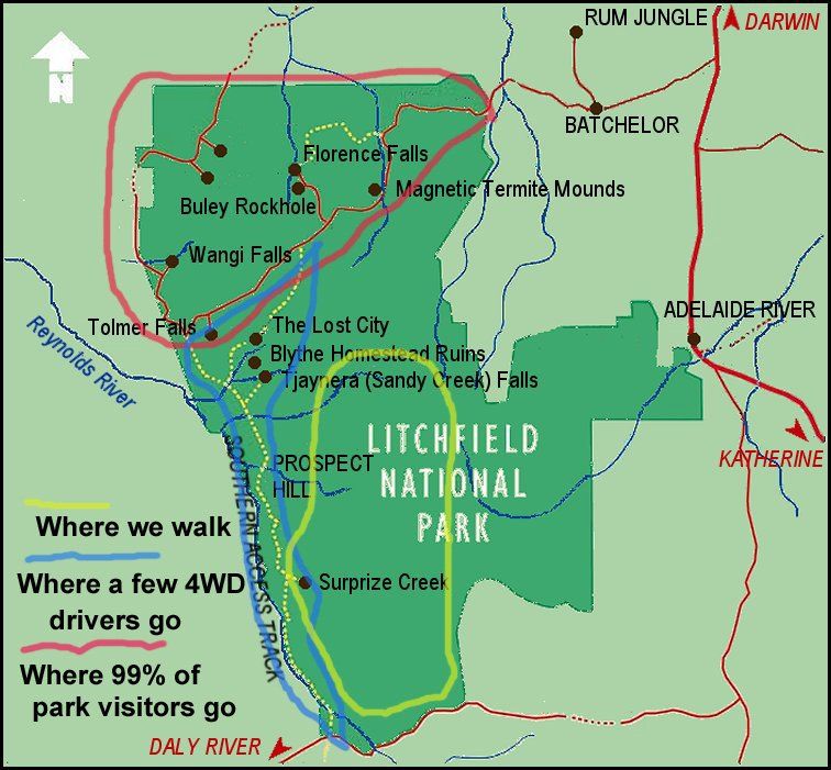
Located less than 150 kilometres from Darwin, Litchfield National Park is a wonderful area full of permanent springs and waterfalls. Although the northern part of the park has been developed for intensive day use, most of the southern part remains an almost untouched wilderness.
We begin near the Lost City, or if the 4WD track to Tjaynera Falls opens early, we cut a few km off the first day’s walk and begin from there. In either case, we camp at a beautiful spot not far above the main falls. It’s such a magnificent spot that we’ll stop there no matter how early we arrive.
The serious walk begins the next morning as we do a short climb and head south toward a tributary of the East Reynolds. Some groups get there by lunch, but it’s such a nice spot that we stop for the day.
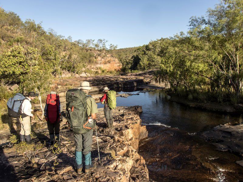
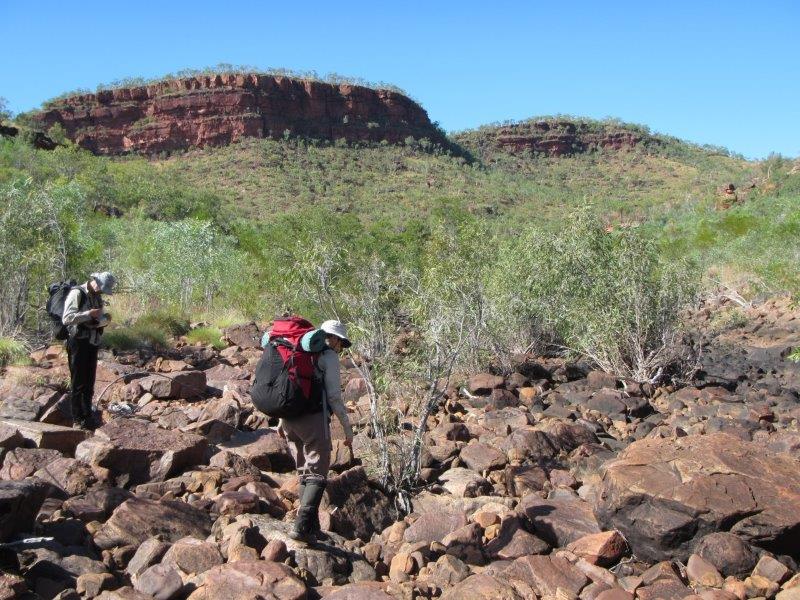
From there, we continue south, crossing the main branch of the East Reynolds. Crossing will almost certainly require a wade. The next stretch is one of the driest of the trip so we will need to carry enough water to get us to camp that evening.
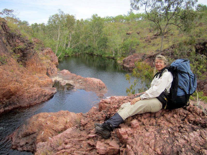
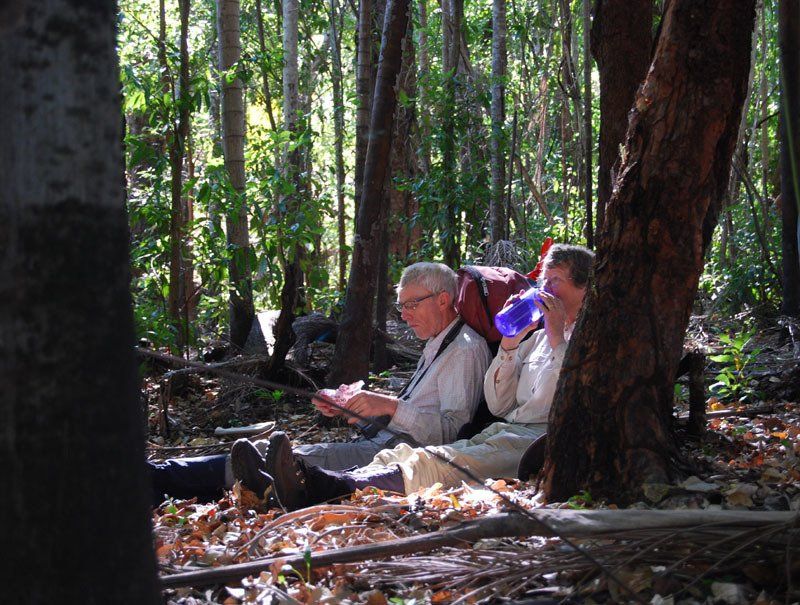
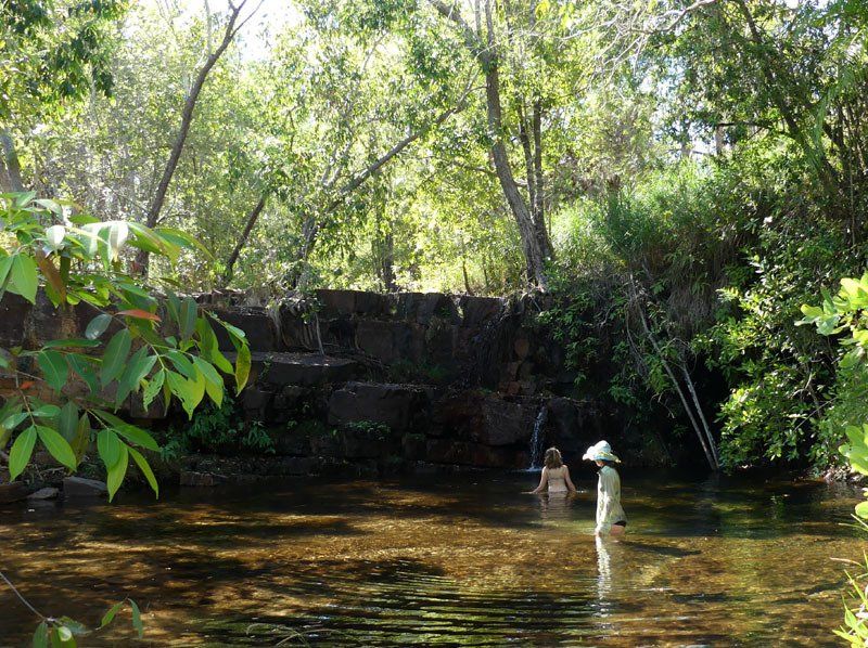
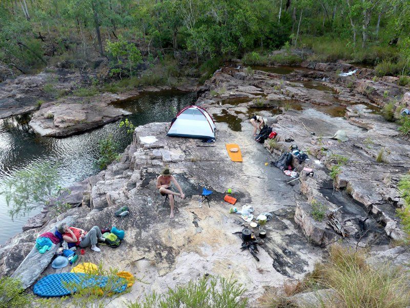
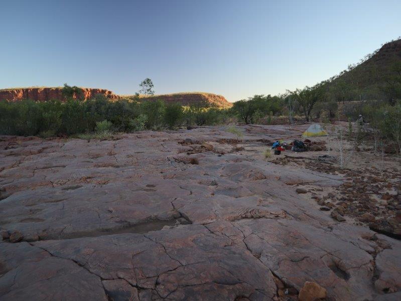
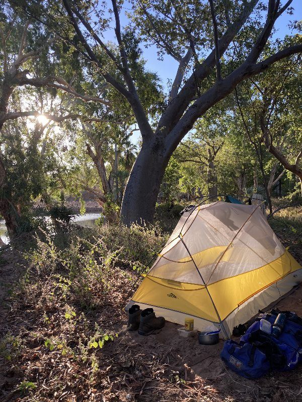
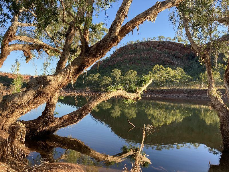
Our normal camp is in a large area where you have the choice of camping on sand or on rock. Plenty of pools and cascades for a swim.
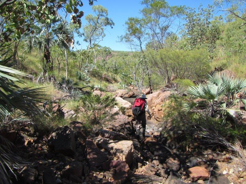
There are a number of ups and downs as we make our way from one creek to the next. We walk through gorges, patches of monsoon forest and open woodland. Swims are frequent as we stop to enjoy the many pools we find along the way.
Finally there is Tableland Creek, the largest creek in the southern part of the park. Pool after pool, waterfall after waterfall, swim after swim, it is a magic spot. Most of the walking is fairly easy but there are likely to be a couple of ups and downs along the way. From our final camp, it is only about an hour to where we meet the vehicle.
At the end of the walk, we drive to Katherine where we resupply before driving another 200 km to the Victoria River Roadhouse where we spend the night in the campground.
Those leaving the trip at the end of this section have the choice of being dropped off in either Pine Creek or Katherine.
2) NE Judbarra/Gregory
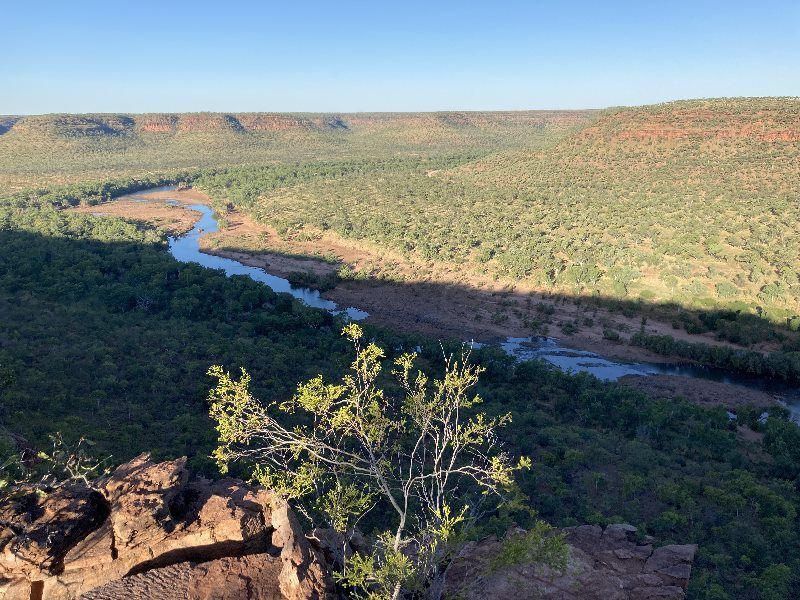
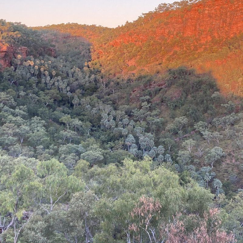
Gregory is one of the largest yet least known national parks in the NT. It lies about halfway between Katherine and Kununurra and contains several creek systems where large permanent pools and shady rock shelters can be found in the depths of sheer, red-walled gorges.
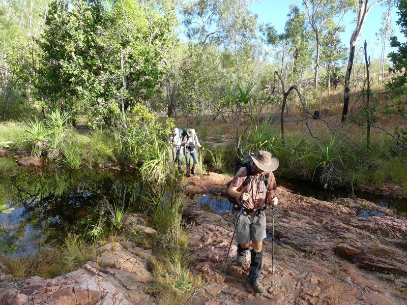
We plan to do a loop along Matt Wilson and Ryan Creeks in the northeast section of the park. This area contains some of the most spectacular cliffs in the park. We do not visit it on any of our other trips. The beginning of the walk depends on the level of the Victoria River. If the river is low enough to walk across at the old crossing, we will do so and save a half day’s walk. If not, we have to start from the Katherine side of the Victoria Bridge and walk from there.
The terrain here is more open and flatter than in Litchfield. There are lots of boabs. In 2019, the group saw numerous freshwater crocs. Somehow they have coped with cane toads better here than in Kakadu or Litchfield. While they are crocodiles, unless you actively provoke them, they are harmless.
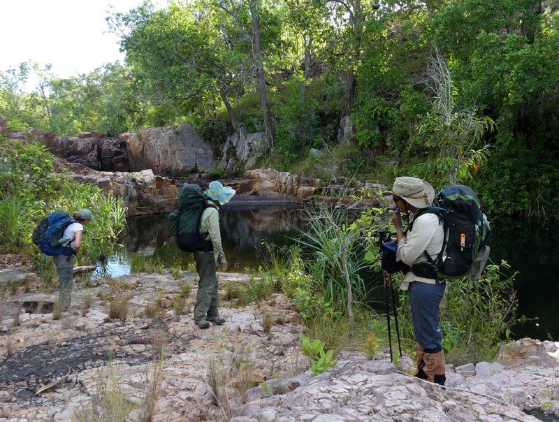
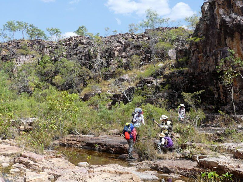
As we work our way up the valley, we sometimes drop our packs and do an exploration of a side gorge. Eventually, we climb up out of the Matt Wilson Valley and cross the plateau heading west toward Ryan Creek. We find a number of high, shallow gorges on the small creeks that feed into Ryan Creek.
Some of the walking is fairly easy. Some has thick scrub and is quite slow. Gregory is much drier than Kakadu or Litchfield so there aren’t a huge number of waterholes on the small creeks, but occasionally we even find a small flowing waterfall .
Once we reach the main creek, the going gets easier and the views more spectacular. As we continue the gorges get deeper. Walking on the top is fairly easy but some of the side gorges are deep enough so that we have to drop down to the main creek or contour well around. There isn’t a lot of difficult terrain, but as the middle photo below shows, there is some.
Eventually, we return to where we began, climb into the vehicle and begin the 530 km drive back to Darwin. (Some groups prefer to finish on the second last day and camp en route to Darwin.)

Details
DATES
27 April - 10 MaySection 1: 27 April - 4 May
Section 2: 4-10 May
PRICES
Full price: A$5395
Section 1: $2995
Section 2: $3095
*discounts available
GROUP SIZE
4 - 12 guests
CAMP SITES
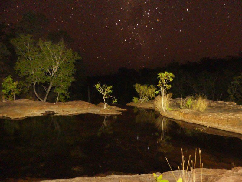
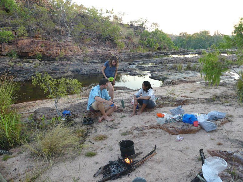
Mix of sand, grassy areas and rock ledges. Most sites are good; some are excellent, some may be no more than average. You are unlikely to see anyone else at any of the campsites.
ART
We may visit some art sites on both sections but the art we have found previously has not been as plentiful or as well preserved as much of what we have found in Kakadu and parts of the Kimberley.
SWIMMING
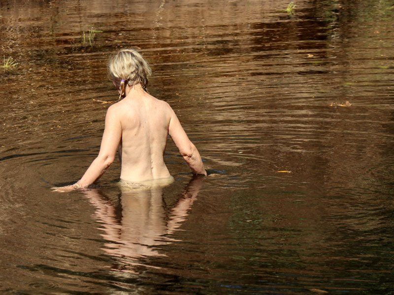
Good pools at most campsites and lunch spots in Litchfield. Good swims in the smaller pools in Gregory but some of the larger pools could contain large crocs. Ask your guide before swimming in the larger pools.
WILDLIFE
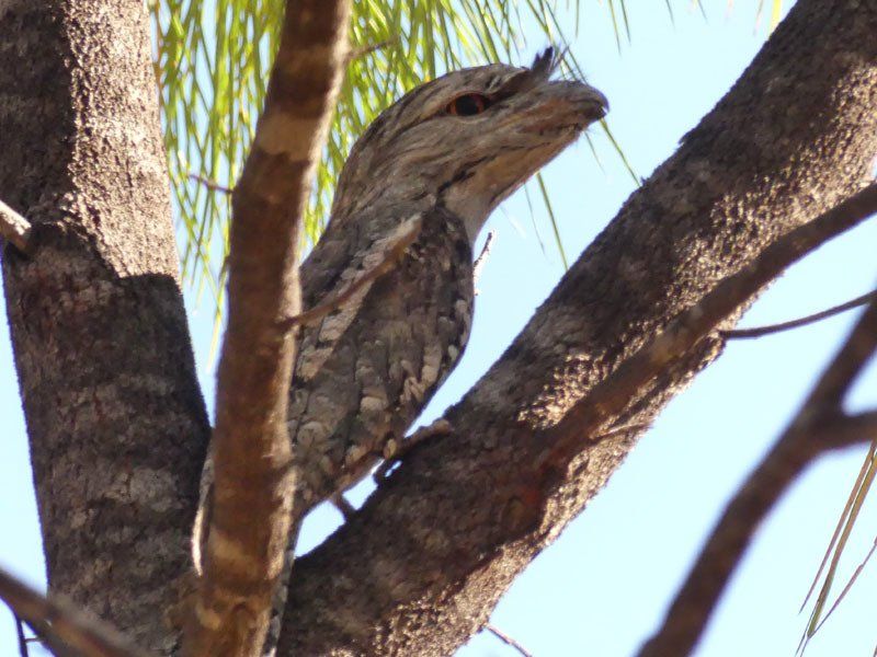
Birds are always present but spread out at this time of year. Litchfield is better for birds than Gregory or most of Kakadu. Gregory is excellent for freshwater crocs and agile wallabies. The 2019 group saw many great bower birds. You are unlikely to see many other large animals.
CLIMATE
Average daytime max 32ºC, average nighttime min 17-20ºC. It can, however, drop below 10ºC. Generally low humidity. Rain is unlikely but possible. We recommend that you bring a tent or mosquito net with a fly or at least a plastic sheet for shelter if we do get an unseasonal rain.
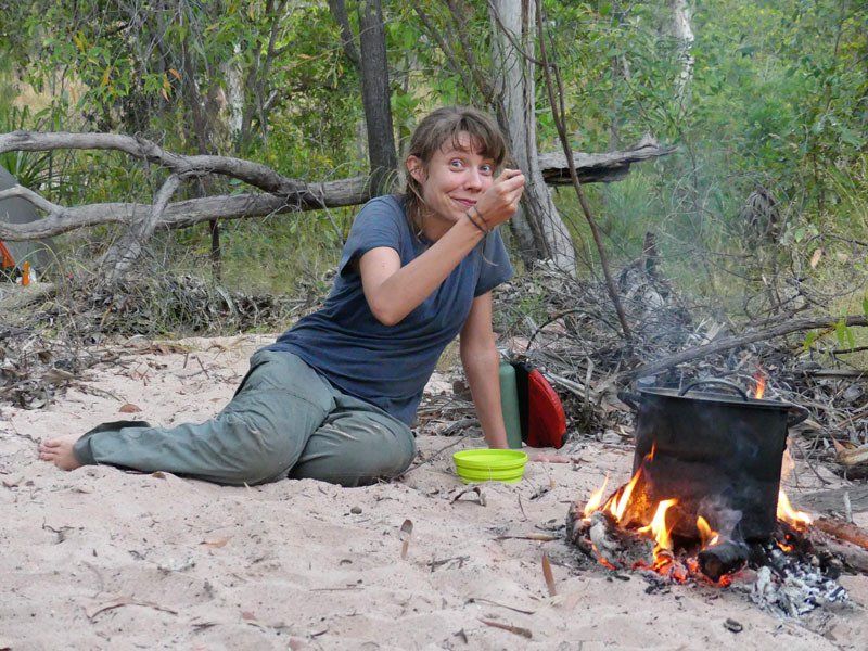
COOKING
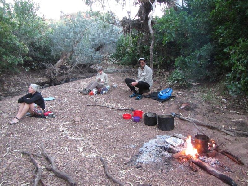
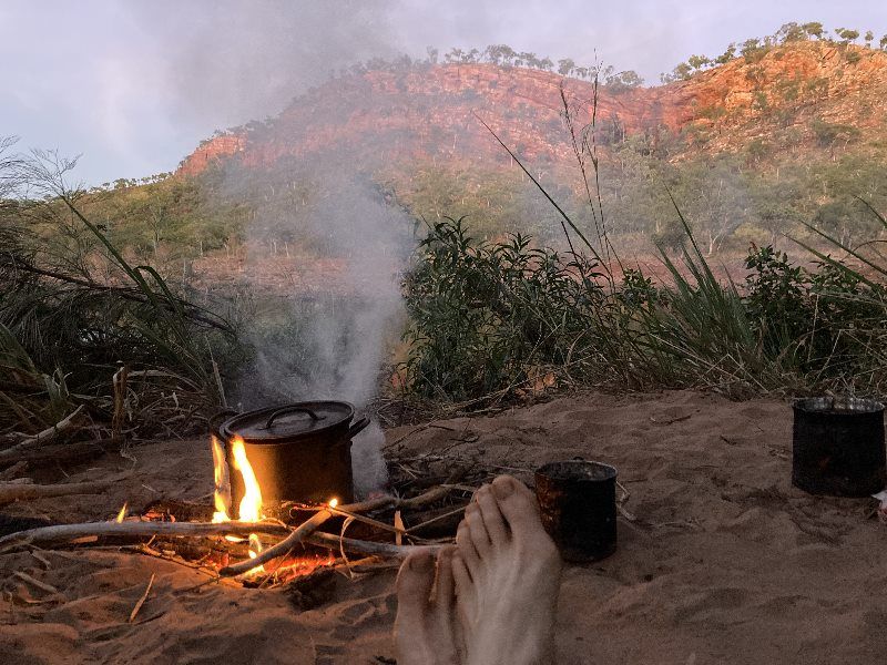
We will have campfires every night and hot water available every morning.
WALK RATING - MODERATE
Terrain
Section 1. Most of the walk is relatively flat. There are, however, a few moderate climbs and a fair amount of rock hopping. There may be sections of thick scrub. We cannot say for sure as this depends how recently the area has been burnt and on how much rain there has been since.
Section 2. The walk along Matt Wilson Creek is relatively flat and easy as is the lower portion of Ryan Creek. In between there are a few steep climbs and a fair amount of rock hopping. The amount of scrub varies depending on the recent history of bushfires and rainfall.
Vegetation
Varies from year to year depending on when last burnt. In May, most of the spear grass has finished seeding and dried out. Based on past experience, we expect some sections of thick scrub and or spinifex which will make some days much harder than others. There are always flowers in bloom.
Distance
4-6 hours per day. A few days might be longer.
Pack Weight
You need to carry 6 days food on each section. You need a light sleeping bag. We recommend a tent or mosquito net with a fly or plastic cover.
Itinerary
*This itinerary is subject to change
You need to click view more to see all the photos in the gallery below. The first 15 are from Litchfield. The last 15 from Gregory. The last five were added in December 2023.


View more