EXPERIENCES / KIMBERLEY
Bungles and Osmond Range
Overview
Two long walks in two very different areas.
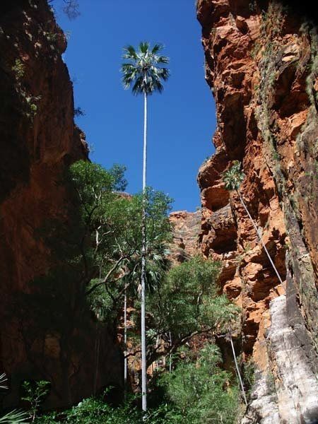
- The Bungle Bungles. While there are many tours which will take you to Purnululu, No one else will allow you to experience as much of the park in as intimate a fashion as ours. We hike up Piccaninny Creek and spend ten days exploring the many side gorges, mostly without full packs. These gorges offer a variety of delights — some are palm filled, some are very narrow and require swimming, some have caves which require the use of a torch. There is at least one gorge that allows us to reach a high point. No words can do justice to the beauty of the area. The only way to appreciate it is to come and see it for yourself.
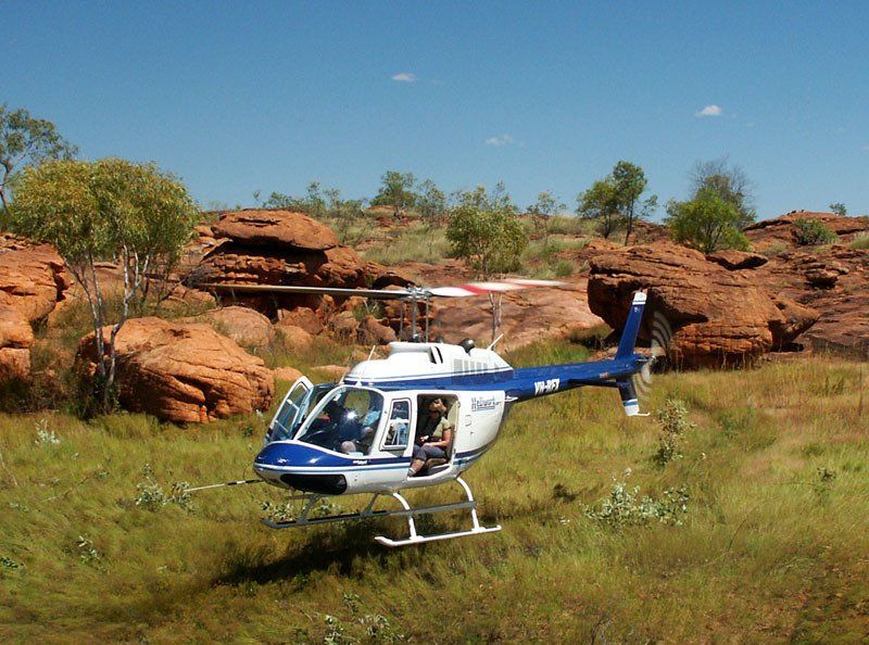
- The Osmond Range. Although this area is very close to the Bungles, it could hardly be more different. The rocks are more angular. Most of the creeks are spring fed and flow well into the dry season, long after those in the Bungles have stopped.. The vegetation remains green and includes the southernmost monsoon forest in the Kimberley. There are even a few small cycad groves. We use helicopters to get there and back, saving two to four days walk.
Videos say more than words can ever do. Here are links to a number of videos from our trips.
1. Bungles in April - 5 minutes
2. Osmond Play List - three 1 minute vertical videos showing the Osmond Range section of this trip.
3. Bungles-Osmond 2025 - 12½ minutes. This video was made by one of the clients on our 2025 trip.
KIMBERLEY
April 18 - May 9 2026
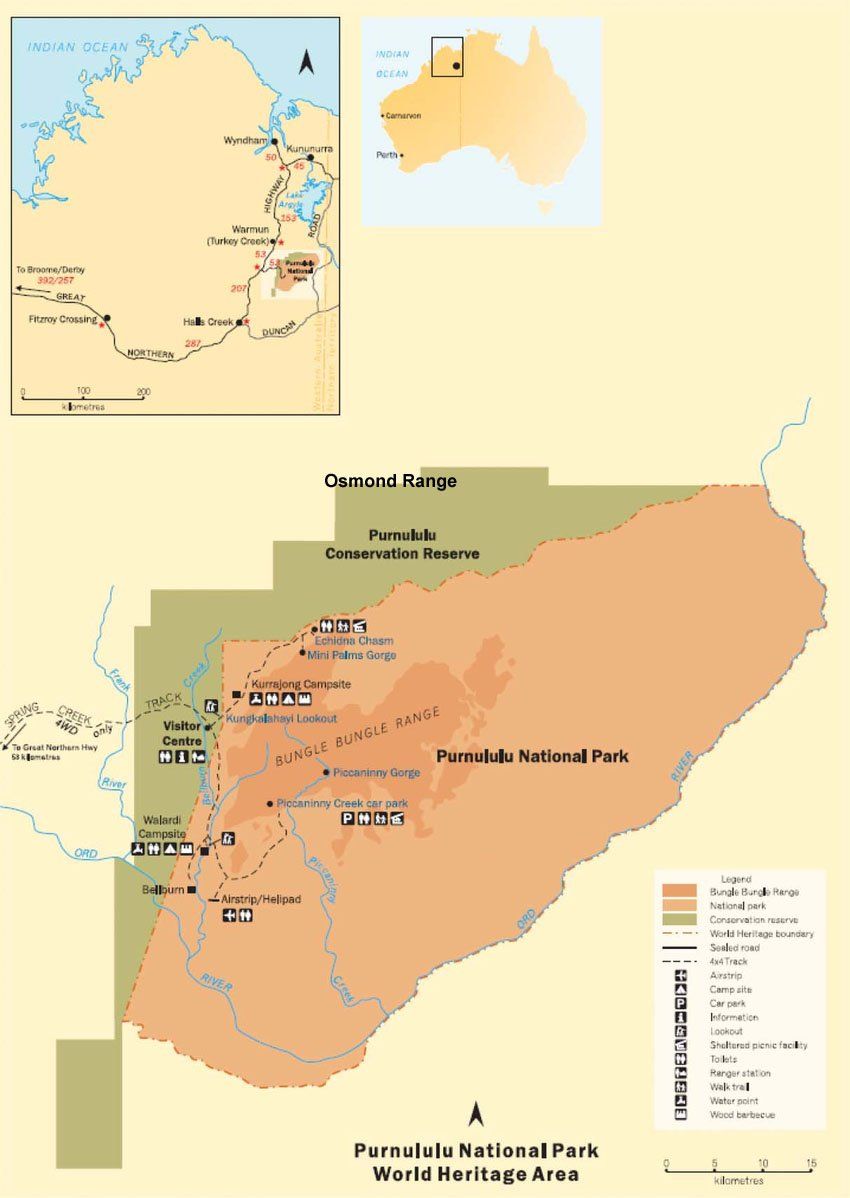
Section 1: The Bungle Bungles
The start of our walk is about 340 kilometres from Kununurra, the last 80 kilometres of which is a 4WD track. The drive takes most of the day but we should arrive with plenty of time to walk to our first camp.
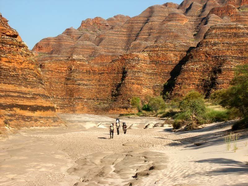
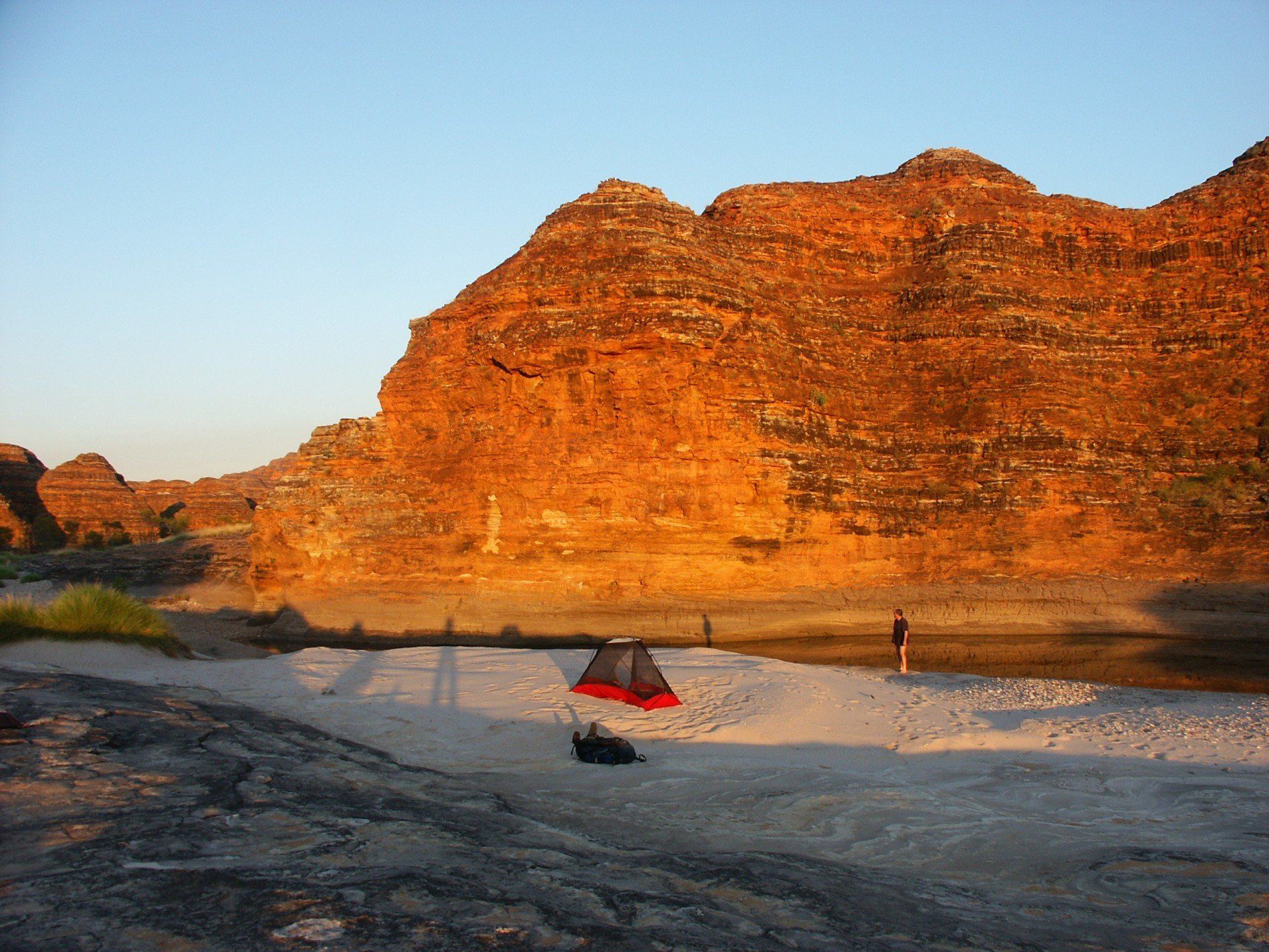
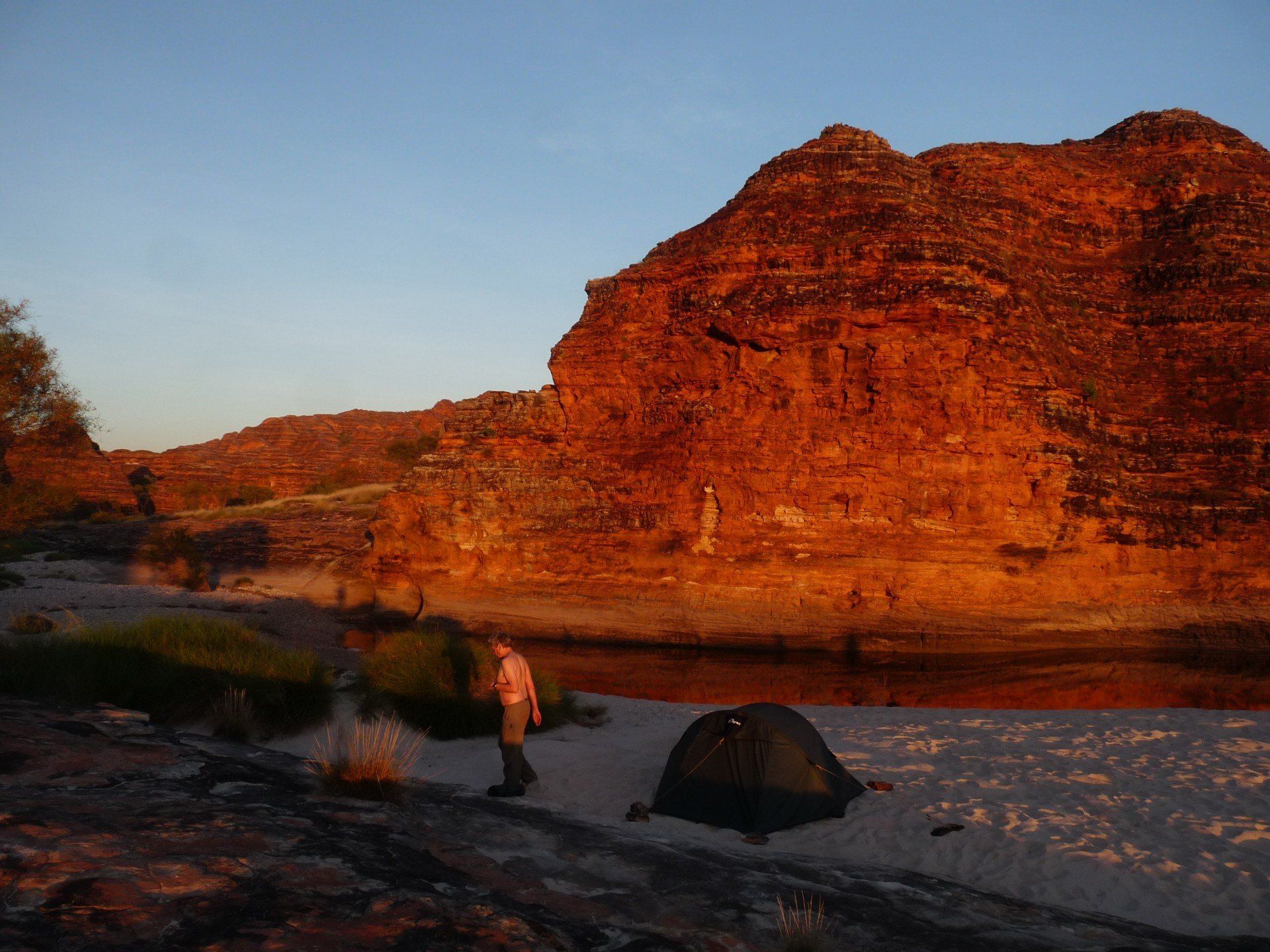
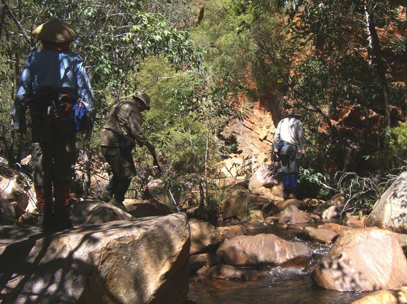
The first part is especially slow and easy as we stop and explore some of the small southern gorges along the way. Eventually we reach a base camp about 12–13 kilometres up Piccaninny Gorge, where sheer red cliffs are silhouetted against the clear blue skies of the dry season.
Piccaninny is by far the largest gorge in the Bungles. We spend three or four nights there using the days to explore the many fascinating side gorges.
Piccaninny is by far the largest gorge in the Bungles. We spend three or four nights there using the days to explore the many fascinating side gorges.
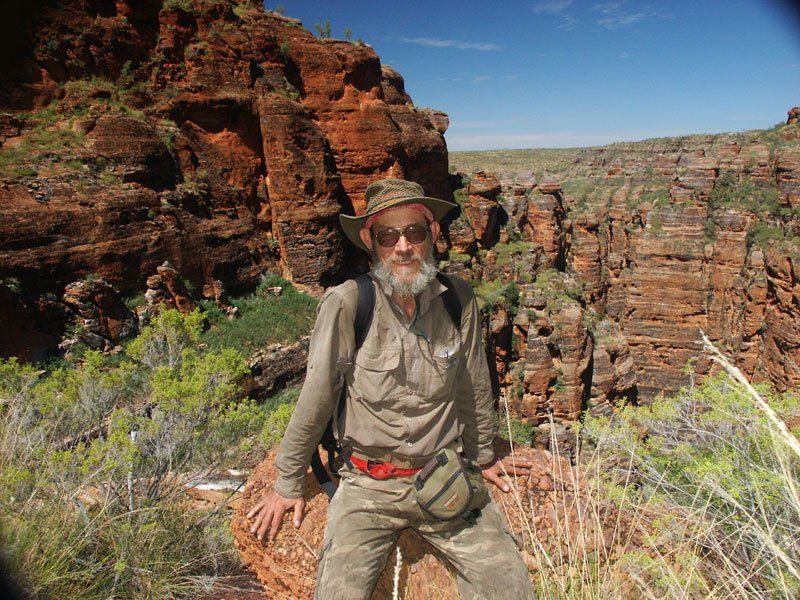
These gorges offer a variety of delights — some are palm filled, some are very narrow and require swimming, some have caves which require the use of a torch. There is at least one gorge that allows us to reach a high point. No words can do justice to the beauty of the area. The only way to appreciate it is to come and see it for yourself.
Cimbing up the domes themselves is not permitted because of their exceptionally fragile nature. We can, however, follow watercourses as far as they will take us ... and that gets us some amazing views.
Cimbing up the domes themselves is not permitted because of their exceptionally fragile nature. We can, however, follow watercourses as far as they will take us ... and that gets us some amazing views.
On the final day, we return to the vehicle and drive to the airstrip where we meet those joining for the second section. Those finishing here will fly back to Kununurra.
Section 2: The Osmond Range
From the Bungles airstrip, we fly to the start of our walk by helicopter.
Exactly where we land can vary from trip to trip, normally close to but not right on one of the many creeks. We are soon enjoying the first of our many swims.
Exactly where we land can vary from trip to trip, normally close to but not right on one of the many creeks. We are soon enjoying the first of our many swims.
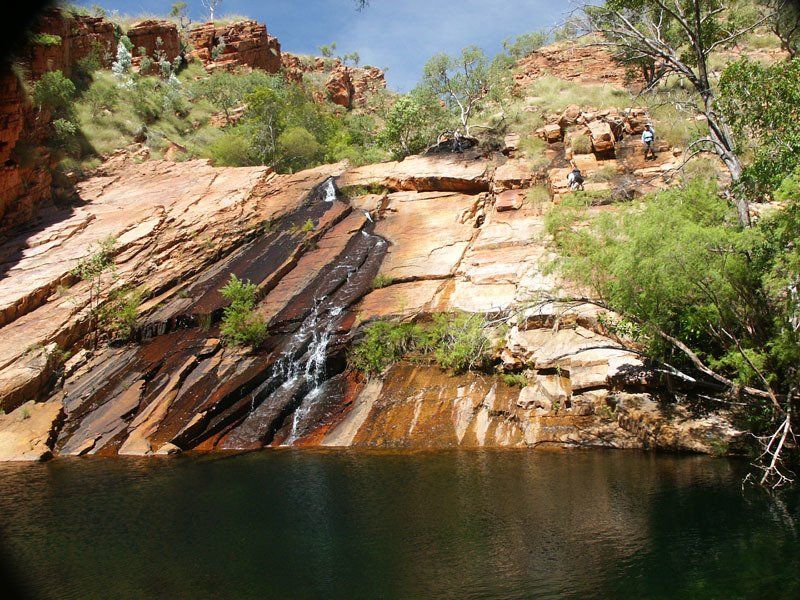
Walking along the top of the plateau is mostly flat and fairly easy – a good way to get from one creek to the next. The creeks, with their waterfalls and gorges, are where the most spectacular scenery is.
In some places we will have to scramble up steep slopes; in others the walking should be flat and easy. Sometimes we will drop our packs and do a day or half-day walk. At other times, we will carry the packs and shift camp from one creek to another.
The vegetation can change dramatically from year to year, so dramatically that the guide on our one trip could scarcely recognise the areas that were described in our notes from three years earlier. The one constant is the lovely gorges, pools and waterfalls which make the Osmonds a special place.
At the end of the ten days, a helicopter picks us up and we fly back to the Bungles airstrip, get into the cars and drive back to Kununurra.
Details
DATES
April 18 - May 9
PRICES
Full price: A$9995. Special discount:
$7495
Sec 1, Bungle Bungles, April 18-27: A$4995 . Special discount: $3995
Sec 2, Osmond Range, April 27 - May 9: $7295. Special discount:
$5795
GROUP SIZE
4 - 12 guests
CAMPSITES
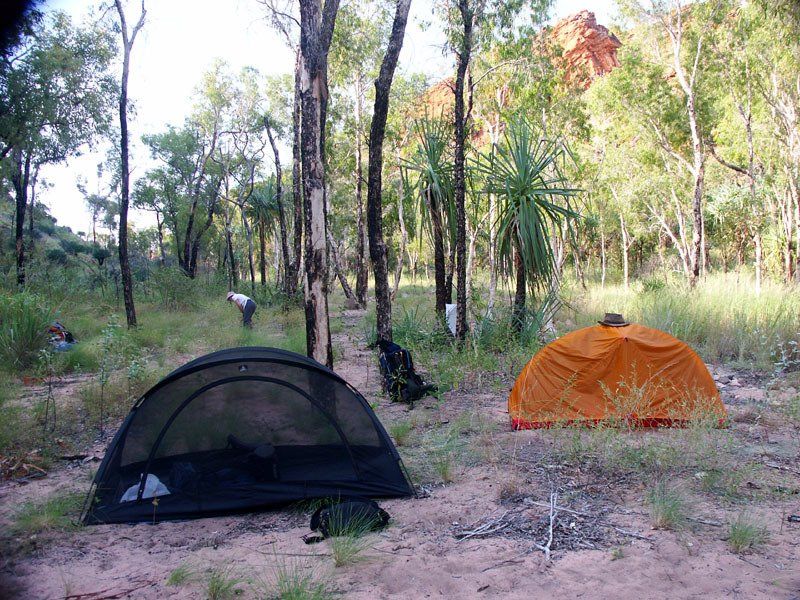
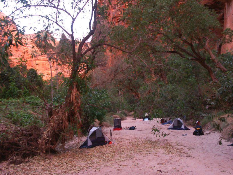
Sec. 1. Mostly on sand, might include rock ledges on some nights. Rain rare but could cause change of site.
Sec 2. Flat areas in the Osmonds tend to be small so some of our campsites are likely to be more crowded or more spread out than normal depending on how large and/or how far apart the tent sites are.
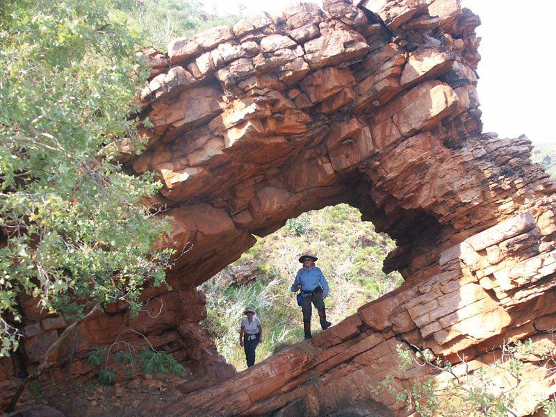
ART
Minor sites, easily missed.
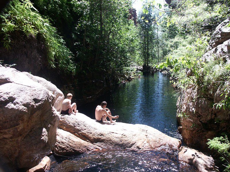
SWIMMING
Sec 1. Normally fairly good. Depends very much on the just finished wet season. The water is warmer and there is more of it than on trips later in the year.
Sec. 2. Magnificent pools and flowing creeks.
WILDLIFE
Birds are always present but we seldom see large groups. Lizards are plentiful spread out at this time of year. You are unlikely to see many large animals.
CLIMATE
This is a relatively hot time of year. The temperature will reach the low to mid 30's most days. Temperatures of 35ºC are not uncommon. The heat reflecting back from the sand and rocks in some areas can make it feel hotter still. The humidity is normally relatively low so the heat will not feel as uncomfortable as it does during the wet season. Nighttime minimum temperatures average 18-20ºC but can go down to about 10ºC so you need to be prepared for cold nights. The pools, especially those which get some some sun, are much more comfortable for swimming than they are later in the year. Although rain is unlikely, it is common enough so you should be prepared for a rainy day or two.
COOKING
We should be able to have campfires on the Osmond section. The Bungles is a stove only area.
WALK RATING - HARD
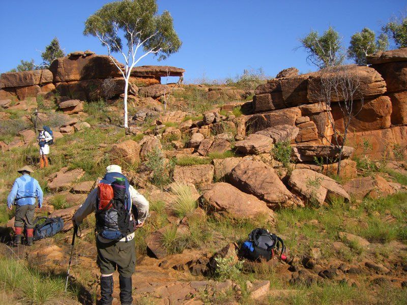
Terrain
Sec. 1.
Although some of the terrain is quite open and easy, much of the walking will be done in narrow gorges. There will be some clambering over large rocks and some edging along narrow ledges. There may also be one long and strenuous climb.
Sec. 2.
With packs - flat, minimal rock hopping, some ledging, some soft sand. The walk up the Piccaninny Gorge, mainly over pebbles and sand can be quite tiring for many people.
Going beyond our first base camp, done with full packs on some trips, requires some clambering over large rocks and includes edging along at least one narrow ledge.
Daywalks without packs - most of the day walks involve clambering over large rocks. Some include steep climbs. Some people find this very difficult, even without full packs.
Vegetation
Sec. 1.
The vegetation can vary dramatically from year to year. We may encounter thick scrub and spinifex or there may be little thick vegetation to push through.
Sec. 2.
With packs - minimal vegetation.
Without packs - some walks include dense sections of sharp and/or sticky spinifex, gaiters essential, long trousers recommended.
Distance
4-6 hours per day
Pack Weight
Waterproofing. We recommend you bring a garbage bag for waterproofing on the off chance that you might get some rain.
You need to carry 10 - 11 days of food on each section. Both sections include day walks where you will not need to carry your full pack.
Itinerary
*This itinerary is subject to change


View more